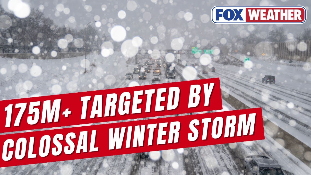
Massive Winter Storm Threatens 175M Americans This Weekend
A 2,000-mile historic winter storm brings snow, ice and dangerous conditions to over 35 states from Friday through Monday.

BREAKING NEWS - Record Winter Storm Diego Wreaking Havoc Across The South
Potentially Historic Winter Storm Set To Slam 175M Across 30 States From Southwest To Mid-Atlantic
This Will Be A Historical Storm...
A potentially historic winter storm spanning over 2,000 miles threatens to disrupt life for millions of Americans this weekend, bringing dangerous snow, ice, and dangerously cold temperatures across more than one-third of the nation.
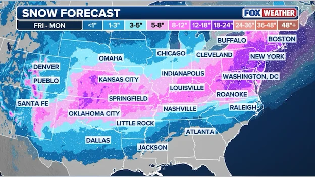
More than 175 million people are in the path of a potentially historic winter storm that's expected to extend over 2,000 miles and deliver crippling snow and ice across more than 35 states, all told beginning Friday. The massive winter storm system is forecast to sweep the country this weekend, stretching from Central Texas through the Northeast.
Unprecedented Geographic Scope
The scope of this system will be immense, with snow and ice stretching from the Southwest through Texas and Oklahoma, across the South and Tennessee Valley, before eventually reaching the Mid-Atlantic coast. Major metro areas in the storm's path include Dallas, Austin, Oklahoma City, Nashville, Atlanta, Charlotte, Washington, D.C., Baltimore, Philadelphia, New York City and Boston.
The storm's sheer geographic footprint represents one of the most significant weather events of the 2026 season. Winter Storm Fern is forecast to engulf an area stretching from Texas and the Great Plains region to the mid-Atlantic and northeastern states, with forecasters warning it could be 2,000 miles long—well over half the length of the continental US.
Dangerous Ice and Power Outage Threat
Among the most serious concerns is widespread ice accumulation that threatens critical infrastructure. Over 15 states stretching across a massive corridor from New Mexico through the South to the Carolinas and Mid-Atlantic coasts could see ice accretion capable of causing numerous power outages from Friday through Monday.
The bull's-eye for the most significant ice accretion, capable of causing widespread power outages, is currently forecast from East Texas through southern Arkansas. Another significant ice threat is forecast to develop across the eastern side of the Appalachians, currently including Atlanta, Augusta, Georgia and Charlotte, North Carolina.
The potential for extended power outages is particularly concerning. AccuWeather chief meteorologist Jonathan Porter said "potentially hundreds of thousands of people may go without electricity and heat for days." Impacts from the snow and ice could cause power outages, widespread travel shutdowns and school closures.
Record Snowfall in Key Regions
While ice poses the primary threat in the South, significant snowfall is expected across portions of the mid-Atlantic and Northeast. The highest snowfall totals from Friday through Monday are expected from Nashville through western North Carolina, including Winston-Salem, where over a foot of snow is likely as colder air will favor a predominantly snow-driven event.
If the scenario where the massive winter storm is able to move off the East Coast and intensify plays out, Philadelphia, New Jersey and New York City could see more than a foot of snow by Monday morning. The further north the storm is able to track, the greater the likelihood of significant snow further north along the I-95 corridor in New England.
Extreme Cold Follows Winter Storm
The winter storm arrives as a brutally cold air mass settles across the nation. Temperatures near or below zero degrees Fahrenheit are set to grip the eastern third of the country this week, with wind chill making it feel as cold as minus 50 in some areas.
An Arctic front is expected to send temperatures plunging below zero in the northern Plains on Thursday and into the mid-Mississippi Valley, the Ohio Valley and the Northeast by Sunday. The frigid air mass will then interact with a frontal zone to the south to generate a major storm through the weekend.
Preparation Urged Ahead of Friday Arrival
Meteorologists and emergency management officials are urging Americans to prepare immediately. Forecasters want people to have their preparations in place by Friday because conditions and hazards are going to get worse throughout the weekend.
Around 49 million people are already under winter storm watches from New Mexico to Tennessee—and the watches are expected to expand on Wednesday. Officials recommend stockpiling food, water, batteries, and medications before conditions deteriorate.
Learning from Previous Winter Storms
While meteorologists expect this storm to be severe, current conditions appear milder than the catastrophic winter storm that struck Texas in 2021. A meteorologist with the NWS in Fort Worth, Texas said freezing temperatures from this storm won't last as long or be as low as they were in 2021, noting that in 2021 the minimum temperature was negative 2 degrees in Texas, while as of right now in the forecast, the minimum temperature is only going to be around 9 to 10 degrees. Still, it will be "dangerously cold."
Despite these comparisons, an energy expert at the University of Houston said while the Texas grid is more resilient than it was five years ago, the cold snap could freeze wind turbines or have other impacts that disrupt power generation.
As Winter Storm Fern approaches, Americans across the affected regions are urged to take precautions, stay informed through official weather updates, and prepare to remain sheltered during what could be one of the most significant winter storms of the season.
Related Articles

Hundreds Honor Alex Pretti in Minneapolis, Fueling National Debate on Federal Force
Hundreds gathered in Minneapolis to honor Alex Pretti, an intensive care nurse shot by federal agents, sparking widespread protests and debate on immigration enforcement practices across the U.S.