Why it matters
A dry, lightning-heavy mid-July has pushed Oregon and Washington past a full typical year of wildfire acreage before August, historically the region's most dangerous fire month, has even begun.
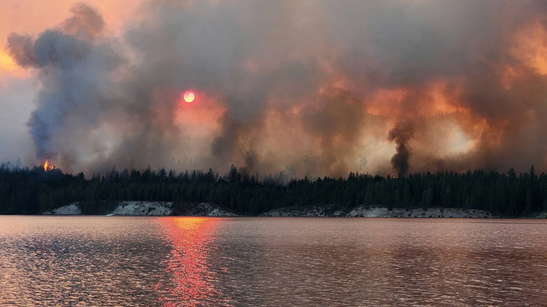
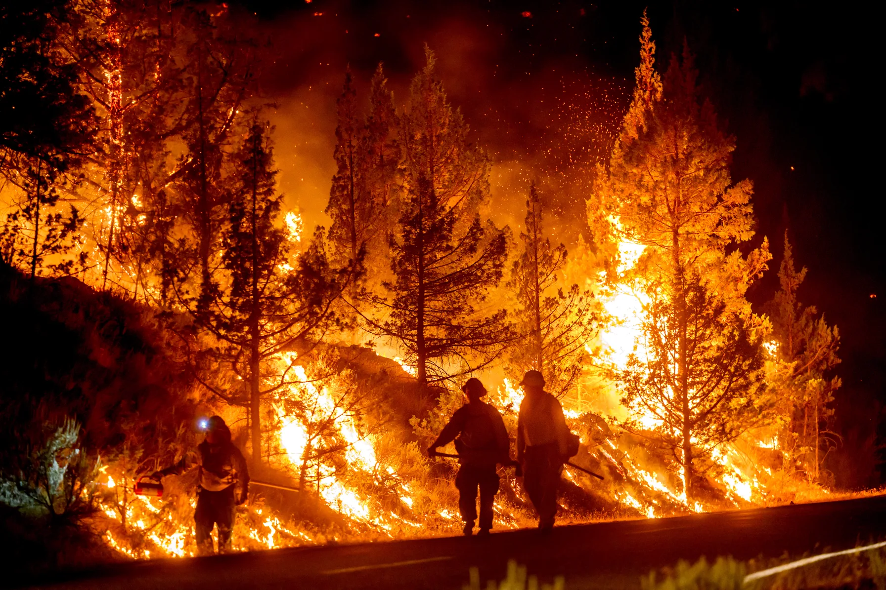
Oregon and Washington have burned a combined 1,322,187 acres so far this year, a figure that as of July 26 already exceeds the ten-year average for an entire fire season in the two states, according to the Northwest Interagency Coordination Center. Thirty-four large wildfires are burning across Oregon alone, the state's forestry agency says, and the largest, the Rowe Creek Complex near Fossil, has grown past 208,000 acres. In Central Oregon, the merged Bench and Beachcomb fires forced the evacuation of nearly the entire Warm Springs Reservation agency area, destroying at least six homes. Oregon Governor Tina Kotek declared a statewide wildfire state of emergency on June 15, before this stretch of large fires even ignited, a declaration that remains in effect and authorizes the Oregon National Guard to be called up for firefighting duty; more than 12,400 firefighters are now deployed statewide, with additional crews arriving from California, Washington, and as far away as Florida. Fire officials describe the season as tracking toward the scale of 2020, 2021, and 2024, three of the most destructive wildfire years the Pacific Northwest has recorded this century, and it is not yet August, historically the region's most dangerous month for fire growth. Washington, meanwhile, is not just supplying mutual aid: its own largest fire of the year is burning simultaneously in Okanogan County, competing for some of the same personnel and aircraft that Oregon needs.
A Season Already Worse Than a Typical Full Year
The 1,322,187-acre combined total for Oregon and Washington is not a projection or an end-of-season tally, it is where the two states stood on July 26, with roughly five weeks of peak fire season still ahead. That figure already exceeds the typical ten-year average for an entire year in the two states combined, and stands in stark contrast to 2025, when the two states burned roughly 570,000 acres across the whole season, well under half of what has already burned this year. The comparison that fire officials keep returning to is 2024, when Oregon alone burned 1.9 million acres and spent close to $300 million on suppression against an annual firefighting budget of about $20 million, a gap the state has had to close with emergency funding in each of the last several record years. Meteorologists point to a dry spring followed by an unusually active and dry lightning season as the proximate cause, a pattern that has now produced back-to-back years of fire activity well outside historical norms for the region. Both the Kaiser Canyon Fire in Washington and Oregon's Rowe Creek Complex, its largest fire of the year, trace back to the same lightning storm system, which passed over the Twickenham area of Wheeler County on July 15 and 16, the same 48-hour window in which the Kaiser Canyon Fire ignited roughly 230 miles to the north. That single weather pattern, repeated across two states in the same window of mid-to-late July, is a large part of why both states crossed major acreage thresholds within days of each other rather than in separate, staggered fire seasons, and why the interagency system built to move crews between states on short notice is now being tested on two major fires at once instead of one.
Oregon's Six Largest Fires, by the Numbers
The Rowe Creek Complex near Fossil in north-central Oregon leads the state at more than 208,000 acres and 31 percent contained, the most progress of any major fire currently burning. The Second Flat fire near Burns has burned more than 76,000 acres and is only 5 percent contained. The merged Bench and Beachcomb fires near Warm Springs, roughly 40,200 acres according to Central Oregon fire officials, have shown what incident commanders described as "extreme behavior, including wind-driven runs and long-range spotting, creating three fronts," and remained at zero percent containment as of this week. The Akawa Butte fire near Sisters has burned more than 27,000 acres at 5 to 6 percent containment. Two smaller but still significant fires, the roughly 24,000-acre Hagen fire in northeast Oregon and the 15,000-acre Grasshopper fire near Mount Hood, round out the state's list of large, actively burning incidents, bringing the number of large fires statewide to 34. Containment percentages across this list vary enormously, from Rowe Creek's comparatively advanced 31 percent down to zero on Bench and Beachcomb, and that spread matters because it means firefighting resources cannot simply be declared successful and redirected; each fire is at a different stage of the same basic sequence of establishing perimeter control, mopping up hot spots, and monitoring for flare-ups, and all of them are drawing from the same statewide personnel pool at once. Taken together, the six fires span nearly the entire length of Oregon east of the Cascades, from Fossil in the north to Jordan Valley near the Idaho border in the southeast, meaning the state's wildfire response this summer is not concentrated in one region that could be reinforced and then stood down. It is instead distributed across multiple incident command structures operating hundreds of miles apart, each competing for a share of the same limited aircraft, hand crews, and heavy equipment that would ordinarily be concentrated on a single major incident in a more typical year.
An Entire Reservation Told to Leave
The human cost has concentrated hardest on the Confederated Tribes of Warm Springs, where nearly 400 people were placed under Level 3 "Go Now" evacuation orders and roughly 1,200 more were told to be ready to leave, covering essentially the entire Warm Springs Agency area where most of the reservation's homes and businesses sit. Resident Alysia Klick'ump described the scramble to leave: "We got packed up in camper to evacuate, and the highway closed on each end of our reservation. We couldn't evacuate and were up until 1 or 2 a.m." With both highway exits from the reservation temporarily closed by fire activity, some residents were effectively trapped for hours during the most urgent phase of the evacuation. Jordan Valley resident Tara Echave, near the separate 200,000-acre Big Grass fire burning close to the Idaho border, put the resource shortage bluntly: "We cannot do it on our own. We need air support and we need ground support from people who are skilled firefighters." Warm Springs is a sovereign tribal nation, and the evacuation order covered essentially the entire agency area, the administrative and residential core where most of the roughly 3,300 people who live on the 1,019-square-mile reservation are actually concentrated, rather than the more sparsely populated outlying land. That concentration of population inside a single evacuation zone is part of why the highway closures Klick'ump described became so dangerous so quickly: with both roads out of the area blocked at once, there was effectively no route left for a resident trying to leave on their own timeline rather than the fire's. As a sovereign nation, Warm Springs coordinates its own evacuation orders with state and federal fire agencies rather than simply receiving instructions from Jefferson or Wasco County, but that coordination did not prevent the highway bottleneck Klick'ump and her family experienced when both routes off the reservation became impassable at the same time.
Resources Stretched From Sacramento to Tallahassee
Oregon's state forestry agency has pulled firefighting crews from California and Washington under standard mutual aid agreements, and, more unusually, from Florida, a state with little wildland fire in common with the high desert terrain currently burning. Oregon Department of Forestry spokesperson Jessica Neujahr said the season is "extremely reminiscent to 2024, which was record-breaking," a comparison that carries weight given how much money and personnel that season ultimately required. Portland Fire & Rescue has rotated crews through six separate wildfire deployments this season while maintaining city coverage through internal rotation, according to division chief Rick Graves, who said out-of-state crews "have a skill set that allows them to perform very well in these wildland incidents." The strain is regional rather than confined to Oregon: crews and aircraft dispatched to fight Oregon's fires are drawn from the same limited interagency pool that Washington needs for its own active fires. Oregon's roughly $20 million standing annual wildfire budget was designed for a baseline fire season, not for a year that, at the current rate, could again require supplemental funding on the order of the $300 million spent in 2024, a fifteen-fold gap between what the state sets aside each year and what a genuinely bad season actually costs to fight. Neujahr's comparison to 2024 is not casual shorthand; it is the same official who has watched the agency scramble for out-of-state help before, and her choice of that specific year as the benchmark, rather than a more generic reference to "a bad season," signals that Oregon's forestry agency is treating this as a repeat of its worst recent stretch rather than a milder variation on a normal year.
Washington Is Fighting Its Own Fire While Lending Crews
Washington is not merely a source of mutual aid in this story, it is fighting a major fire of its own. The Kaiser Canyon Fire in Okanogan County, on the Colville Reservation near Nespelem, had burned more than 126,000 acres and was 16 percent contained as of Tuesday, making it the largest active wildfire in the state and a direct competitor with Oregon's fires for the same regional crews and aircraft. Smoke from Washington's own northeastern fires, not primarily Oregon's, has been the bigger driver of hazy skies and elevated particulate readings in the Puget Sound region in recent weeks; West Seattle sensors showed air quality drifting from "good" to "moderate" as smoke moved in from fires burning in the northeastern part of the state. Separately, an air quality alert has covered Whatcom and Skagit counties this week for smoke arriving from British Columbia, a reminder that a Washington resident's nearest wildfire smoke source this summer is about as likely to be domestic or Canadian as it is to be Oregon's. "People need to stay indoors. Close your doors and windows and filter your indoor air," said Erica Littlewood, a public health educator with Whatcom County Health and Community Services, who recommended vulnerable residents pick up fans and portable air filters that the county has been delivering to homes; Bellingham's public library and its Port ferry terminal have also opened as designated cleaner-air refuge spaces. An air quality scientist with the Puget Sound Clean Air Agency separately rated conditions earlier this month at roughly a 3 on a scale of 10, using the severe September 2020 smoke event, when Seattle briefly registered among the worst air quality of any major city in the world, as the 10. That comparison is a useful reminder that even a summer this bad for total acreage burned has not, so far, produced smoke exposure in Western Washington on the scale of the region's worst historical episode.
How 2026 Stacks Up Against the Region's Worst Years
Fire officials keep drawing the same comparison for a reason: 2020, 2021, and 2024 mark the three most destructive wildfire seasons the Pacific Northwest has recorded this century, and 2026 is tracking alongside them rather than behind. Oregon's 1.9-million-acre 2024 season is the most direct precedent, both for its scale and for the way it forced the state to spend roughly fifteen times its annual firefighting budget on suppression alone. What distinguishes 2026 so far is timing: the region typically sees its largest fire growth in August, and this year's million-acre-plus total was reached before that month even began. If growth in the coming weeks tracks anywhere close to the pace of the last two, 2026 is positioned to challenge 2024 for the worst season on record rather than simply resemble it from a distance. Executive Order 26-10, the emergency declaration Kotek signed in mid-June, was issued when the state had recorded 414 fires covering roughly 8,077 acres for the entire year, a number that seemed significant at the time and now looks small next to a single fire, Rowe Creek, that alone has burned twenty-five times that much land. The gap between where the season stood in mid-June and where it stands now is itself a measure of how much the picture has changed in six weeks, and it is the reason state officials describe the current run of large fires as a distinct, more dangerous phase of the season rather than a continuation of what was already underway. Kotek's declaration anticipated the risk in general terms, citing extreme temperatures, dry vegetation, low snowpack, and wind, all conditions that existed before a single major fire had ignited; what has happened since is that the specific trigger those conditions were waiting for, a widespread dry lightning event, arrived in mid-July and hit both states within the same 48 hours.
Five Weeks of Peak Season Still to Come
None of Oregon's largest fires are more than a third contained, and Washington's Kaiser Canyon Fire is not projected for full containment until August 15 at the earliest. With August, historically the region's highest-risk month for explosive fire growth, still ahead, the more than 12,400 firefighters currently deployed in Oregon and the roughly 1,000 assigned to Kaiser Canyon in Washington are unlikely to see meaningful relief soon. For residents of Warm Springs, Jordan Valley, Fossil, and Nespelem, the practical reality is a fire season that has already outpaced a typical full year with more than a month of the most dangerous stretch still ahead, and firefighting resources that both states, and now Florida, are stretching thin to cover it. What happens next depends heavily on weather that cannot be forecast with confidence more than a few days out: another round of dry lightning like the one that started both Rowe Creek and Kaiser Canyon would strain a system that is already running near capacity, while an early wet spell, the kind that sometimes arrives in the Pacific Northwest in late August, could meaningfully slow growth on fires that are currently expanding by tens of thousands of acres a week. Until the weather resolves one way or the other, the safest reading of the current numbers is that they mark a point along the way rather than the season's high-water mark. For now, the clearest throughline across both states is how much of this summer's damage traces back to a single 48-hour stretch of dry lightning in mid-July: it started the largest fire in each state, and the response to those two fires alone, more than 12,400 personnel in Oregon and roughly 1,000 in Washington, already accounts for the bulk of the region's committed wildland firefighting force with a month of the most dangerous part of the season still to come.

Editorial Team
The Vyraa Newsroom is the staff byline of Vyraa, an independent local news outlet covering Bremerton, Kitsap County, and Washington State, published by Nyza Creations LLC. Stories under this byline are researched and written by the Vyraa editorial team from local and regional out…