Why it matters
This is now the largest active wildfire in Washington, burning almost entirely on the Colville Reservation, displacing over 1,000 residents and destroying at least 20 homes while resources are stretched thin by Oregon's simultaneous record fire season.
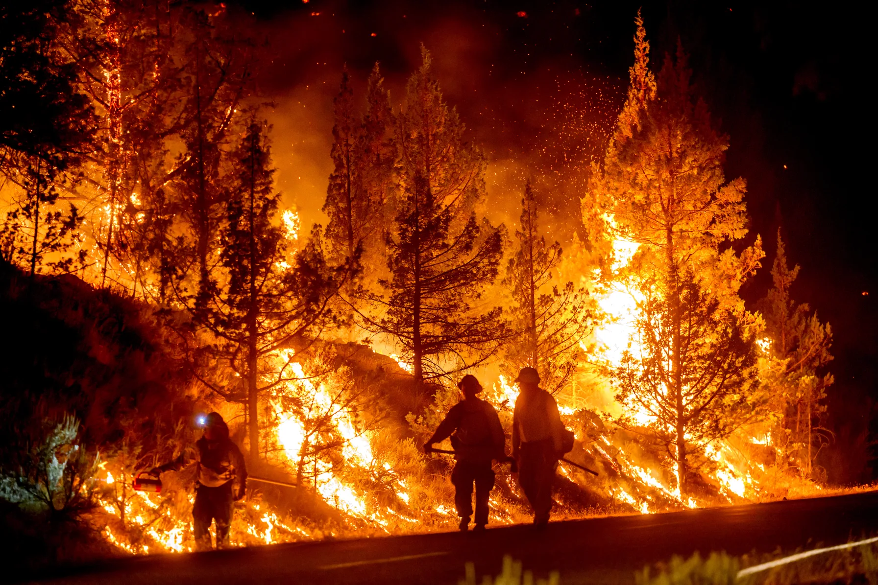
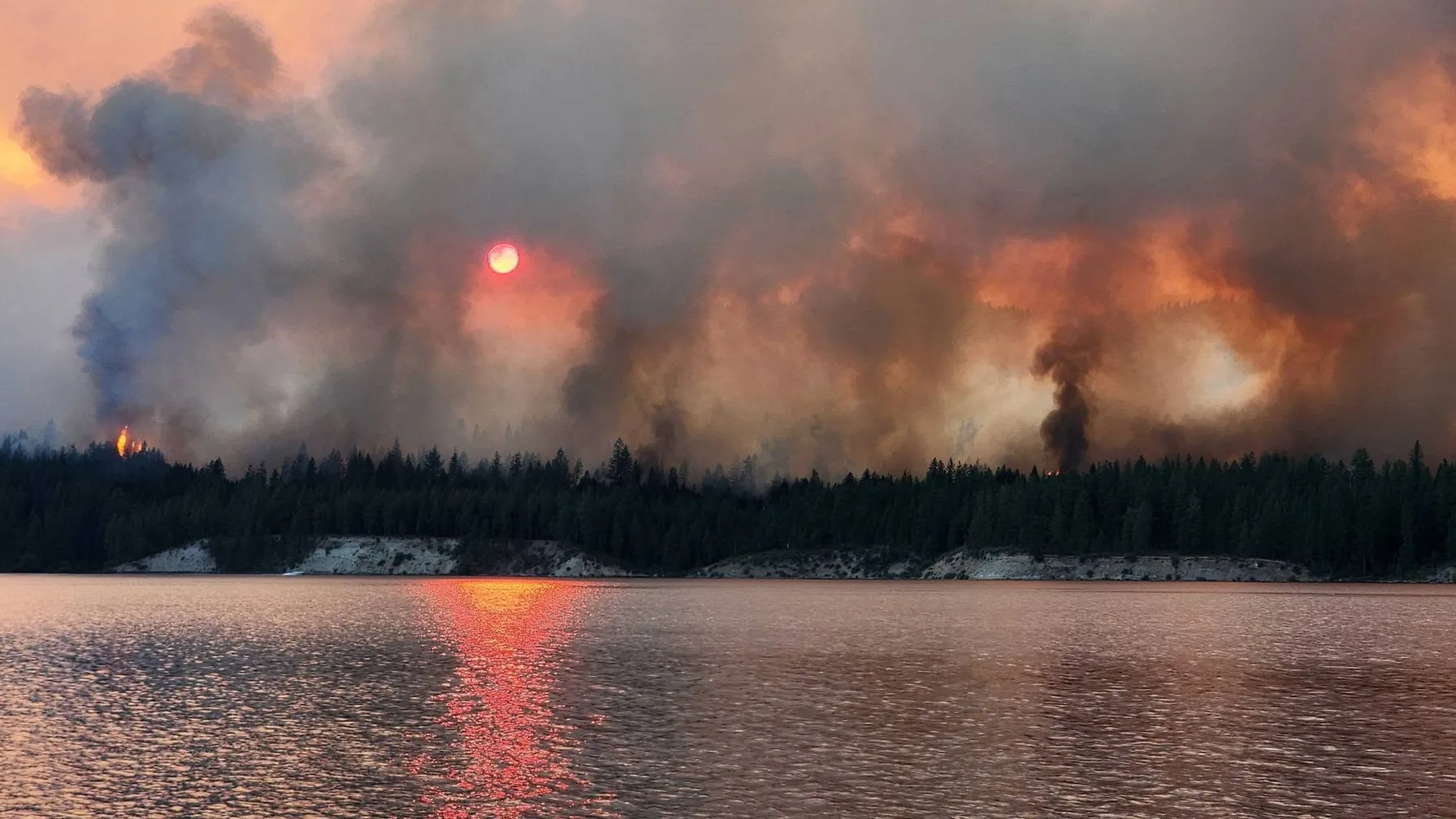
A lightning strike a mile outside Nespelem on the morning of July 16 has grown into the largest wildfire burning in Washington this year. As of Tuesday afternoon, the Kaiser Canyon Fire had burned 126,402 acres of the Colville Reservation in Okanogan County and was 16 percent contained, according to the federal incident tracker InciWeb, which timestamped the figure at 2:42 p.m. Twelve days after ignition, the fire has destroyed at least 20 homes, displaced more than 1,000 people, and cost the Confederated Tribes of the Colville Reservation an estimated $11.1 million. Federal officials now project the fire will not be fully contained until August 15.
The numbers describe a fire that grew faster than crews could build line around it. It covered roughly 68,000 acres by July 20, more than 106,000 by July 24, and over 124,000 by July 27, a pace that outstripped nearly every other blaze burning in the Pacific Northwest this summer. It is now the dominant story of a wildfire season that has already burned more than 1.3 million acres across Washington and Oregon combined, more than triple what Oregon alone recorded in all of 2025.
A Lightning Strike Near a Town of 700
The fire ignited around 6 a.m. on July 16, roughly a mile from Nespelem, a town of about 700 people that serves as the headquarters of the Confederated Tribes of the Colville Reservation. Lightning is the recorded cause, striking dry timber during an early-summer storm that produced little rain, the same pattern of dry lightning that has ignited a disproportionate share of large Western fires in recent years because it arrives without the moisture that would otherwise suppress a strike before it catches. Within three days the fire had grown to more than 62,000 acres and prompted the first evacuation orders. By July 20 it had expanded past 60,000 acres and had physically surrounded the town, though Nespelem itself remained standing as flames burned through the hills less than two miles to the east and west. The Okanogan County Emergency Management office and the Colville Tribes' own fire program made the initial calls on evacuation zones, working from a fire that was effectively doubling in size every three to four days through its first two weeks, a growth rate that gave crews almost no window to build containment lines ahead of the flame front rather than simply reacting to where it had already burned. The fire's name comes from the canyon terrain it originated in, and that geography is part of why early containment lagged so far behind acreage: canyon and ridge topography tends to accelerate fire spread compared with open, flatter ground, which is consistent with a fire that grew from ignition to more than 60,000 acres in under a week.
Containment Numbers That Don't Agree, and Why
Anyone tracking this fire through local television and wire coverage this week has likely seen conflicting containment figures: 9 percent in one report, 13 percent in another, 16 percent in InciWeb's Tuesday afternoon update. That is not sloppy reporting so much as a byproduct of how incident management teams work. Containment percentages are recalculated once or twice a day as crews complete and verify fire lines, and outlets on tighter publishing schedules sometimes carry the prior cycle's number well into the next day, or pull from a wire snapshot taken hours before an afternoon update lands. InciWeb, fed directly by the incident management team assigned to the fire, is the authoritative figure at any given moment; Tuesday's 16 percent reflects real, if incremental, progress from the 15 percent reported in Monday's daily update, when the fire measured 124,251 acres and 884 personnel were assigned. A day later, personnel had grown to 1,004. The acreage figures tell a more useful story than containment alone. The fire grew roughly 20,000 acres a day in its first week, but from July 24 to July 28 it added about 20,000 acres over four days, a pace closer to 5,000 acres daily. That slowdown, even as the mapped perimeter keeps expanding, is what crews point to as evidence the fire is being fought effectively; total acreage keeps climbing because the fire is still finding unburned fuel at its edges, but the rate at which it is finding that fuel has fallen by roughly three-quarters since the second week.
What the Fire Has Taken From the Colville Reservation
The Confederated Tribes of the Colville Reservation have absorbed the fire's heaviest losses, because the fire is burning almost entirely on reservation land rather than the mix of federal forest and private timber that makes up most large Washington wildfires. At least 20 homes and 18 smaller structures, sheds, outbuildings, and similar property, have burned, with damage assessments putting the tribes' losses at $11.1 million. That figure covers structures and infrastructure counted so far; it does not include grazing land, timber, or cultural and archaeological sites within the burn area, categories tribal officials have said will take longer to assess once crews can safely access the interior of the fire perimeter. More than 1,396 homes and another 170 residential and non-residential buildings remain under threat as the fire perimeter continues to shift with the wind. More than 1,000 residents have been displaced, many of them tribal members whose families have lived on this land for generations, and some of whom are now sheltering more than an hour's drive from home. A shelter opened at Nespelem School for those unable to stay with relatives or find lodging elsewhere in Okanogan County, and it has remained in operation through the fire's second week, run in part by tribal staff alongside county emergency management volunteers.
Level 3 Orders Still Stand Across Okanogan County
"Go Now" evacuation orders remain in effect for a wide arc of territory: both sides of Highway 155 from Coyote Creek Campground to Haley Creek, continuing south to Omak Lake Road, Columbia River Road, and Kartar Valley Road, plus the Highway 21 corridor from South Empire Creek to South Nanamkin Creek Road. Areas east of Gold Lake Road and 8th Street inside Nespelem itself carry Level 3 status, along with Columbia River Campground, Buffalo Lake Road, Rebecca Lake, and Belvedere. The rest of Nespelem sits at Level 2, "be ready," with access restricted to tribal members and local traffic while mop-up operations continue near the town's edge. That patchwork of Level 2 and Level 3 zones within a single small town is unusual even for a fire this size, and it reflects how directly the perimeter cuts through inhabited areas rather than staying confined to the surrounding forest and rangeland. Okanogan County's emergency alert system is updating the zone map as containment lines shift, and residents are being told not to expect a return to Level 1 status, meaning no known danger, before the fire is substantially better contained than it is today. Washington's standard three-tier evacuation system treats Level 2 as "be ready," meaning residents should have essentials packed and a route planned, not as a signal that danger has passed. With the fire only 16 percent contained and mop-up still active at the town's edge, Nespelem's Level 2 status functions less as reassurance than as a warning that conditions can still change quickly enough to require Level 3 again.
A Federal and Multi-Agency Response Now a Thousand Strong
The Northern Rockies Incident Management Team 2 took command of the fire in its first week, coordinating Colville Tribes fire personnel alongside state and federal crews with support from the Tolman Fire Center. As of Sunday's daily update, when the fire measured 110,335 acres, the assigned force stood at 656 personnel, 16 hand crews, 28 engines, and two helicopters; by Tuesday that had grown to 1,004 personnel as the incident management team pulled in additional resources to match the fire's continued spread. The Federal Emergency Management Agency approved a Fire Management Assistance Grant on July 17, the day after ignition, freeing federal money for suppression costs before the fire had even reached 10,000 acres, an unusually fast turnaround that reflected how quickly the threat to Nespelem became apparent. That early federal backing has mattered because Washington is not the only state competing for firefighters this summer: Oregon's state forestry agency, fighting its own record season simultaneously, has had to pull in crews from as far away as Florida, leaving Washington's fire competing for some of the same regional aircraft and personnel that Oregon needs for its own 34 active large fires. Oregon fire officials have described this year as reminiscent of the state's record 2024 season, when 1.9 million acres burned and cost roughly $300 million in suppression spending against an annual firefighting budget of about $20 million; Oregon Department of Forestry spokesperson Jessica Neujahr said this month, "We're in a season extremely reminiscent to 2024, which was record-breaking." That comparison matters for Washington too, since the two states draw from the same regional pool of hand crews, engines, and aircraft when a season runs this hot on both sides of the Columbia River.
An August Containment Target, and a Season Not Yet at Its Peak
Federal officials are projecting full containment by August 15, nearly a month after ignition, a timeline that assumes no major wind events reshuffle the fire's edges before then. A red flag warning covering parts of both Washington and Oregon was in effect through the fire's third week, signaling the low humidity and gusty conditions that have driven its growth. For Okanogan County, the practical question is less about the calendar date than about what comes after: assessing 1,396 threatened homes once evacuation orders lift, rebuilding for families who lost structures, and doing it while August, historically Washington's driest and highest-fire-risk month, is still ahead rather than behind. The Kaiser Canyon Fire is currently the state's largest active blaze, but with a month of peak fire season still to come and Oregon's fires nowhere near contained either, it is not guaranteed to hold that distinction, or to be the last fire this size Washington sees before autumn rain finally arrives. August has historically been Washington's highest-risk month for large fire growth, and it has not yet begun; the resources currently stretched thin across Okanogan County and central Oregon, where Portland Fire & Rescue alone has rotated crews through six separate fires this season, have another four to six weeks of peak conditions to get through before the calendar turns in their favor.

Editorial Team
The Vyraa Newsroom is the staff byline of Vyraa, an independent local news outlet covering Bremerton, Kitsap County, and Washington State, published by Nyza Creations LLC. Stories under this byline are researched and written by the Vyraa editorial team from local and regional out…